Railfan Forums Railfan Photos ABPR Archives Staff Safari Photos Staff Safari Video Railfan Links

Dan Syrcher's Railfan Photos
Also see Dan's Buffalo Central Terminal Aerial Photos
and West Shore Dismantlement page
and Remnants of the Niagara Falls Gorge Railway
and Liberty Belle B-17 Flying Fortress Ride
and Concrete Central Photos

You are visitor (graphical counter) to Dan Syrcher's Railfan Photos

All photos © Dan Syrcher unless otherwise noted.
To email Dan Syrcher replace -AT- with the @ symbol on his email address.

[Previous (26 to 50)]   Photos 51 through 75 of 186 total   [Next (76 to 100)]     [All]

Sort By:   Alphabetical   -   Reverse Chronological   -   Chronological   -   Reverse Filesize   -   Filesize


51/186


From: "Dan Syrcher" sst703 -AT- verizon -DOT- net
Date: Tue Apr 12 22:38:17 2011
Subject: Keeping to the right takes you to Galeton. Keeping to the left takes you to Keating Summit.
image/jpeg, 2592x1944 (24bit)
IMG_0051.jpg    536388 bytes

52/186


From: "Dan Syrcher" sst703 -AT- verizon -DOT- net
Date: Wed Jul 14 22:53:59 2010
Subject: After riding the new rail to trail path in Lancaster, NY I stretched out my exploration east of Town Line Rd. This is the picture where the row crossed over Ellicott Creek near Wende Rd. Nothing but the concrete abutments remain. The creek is about 30 feet below.

The unconverted row is in good shape for the most part and looks as good as the B&S RR in PA shown below.
image/jpeg, 2048x1536 (24bit)
DL+W1-7-14-10.jpg    531215 bytes

53/186


From: "Dan Syrcher" sst703 -AT- verizon -DOT- net
Date: Tue Apr 12 21:46:39 2011
Subject: My friend Chris met up with me as I came down the final section. The r-o-w begins to flatten out as it drops down into the valley headed towards Wharton, Pa. I am now off the mountain that 2&3 sit on.
image/jpeg, 2592x1944 (24bit)
IMG_0087.jpg    520195 bytes

54/186


From: "Dan Syrcher" sst703 -AT- verizon -DOT- net
Date: Tue Nov 9 17:03:53 2010
Subject: This is the trackside view from the Clarion/Little Toby Rail-Trail in Ridgway, PA. I wasn't lucky enough to have good timing so I didn't catch any train traffic. I'll try it again another time.
image/jpeg, 2048x1536 (24bit)
Toby_Trail.jpg    511690 bytes

55/186


From: "Dan Syrcher" sst703 -AT- verizon -DOT- net
Date: Tue Apr 12 22:41:10 2011
Subject: Standing in “the bowl” of switchback 3 looking back.
image/jpeg, 2592x1944 (24bit)
IMG_0048.jpg    505664 bytes

56/186


From: "Dan Syrcher" sst703 -AT- verizon -DOT- net
Date: Tue Apr 12 22:44:52 2011
Subject: This is the end of SB 3.
image/jpeg, 2592x1944 (24bit)
IMG_0047.jpg    493983 bytes

57/186


From: "Dan Syrcher" sst703 -AT- verizon -DOT- net
Date: Tue Apr 12 23:23:09 2011
Subject: My friend and I assumed that Junction Rd was too deep in snow to drive on so he dropped me off at Junction Rd and Rt44. It turned out that the road was packed down to pure ice. Going up hill was a small problem but once I got over the crest, it was all down hill. It was scary as hell x/c skiing on pure ice down hill and especially near the curves. I tried to keep my skies in the frozen snowmobile tracks just to maintain directional control. It was so bad, that I was prepared to fall over in case I really lost control. This photo was taken at Boone Hill Vista and the RR r-o-w is about 100 feet below me.
image/jpeg, 2592x1944 (24bit)
IMG_0023.jpg    429355 bytes

58/186


From: "Dan Syrcher" sst703 -AT- verizon -DOT- net
Date: Tue Apr 12 22:00:06 2011
Subject: Another washout.
image/jpeg, 1944x2592 (24bit)
IMG_0080.jpg    422520 bytes

59/186


From: "Dan Syrcher" sst703 -AT- verizon -DOT- net
Date: Tue Apr 12 23:04:44 2011
Subject: I am standing on the clearing where the natural gas line is. You can clearly make out the r-o-w at the tree line. Switchback 3 is about 50 minutes away. SB 2 is far below and to the right not in view and about 2 hours away. If your on this trail and an avid x/c skier, you can do this trail much faster. But when you’re exploring a historical RR, you stop and “research” the area. It takes time.
image/jpeg, 2592x1944 (24bit)
IMG_0030.jpg    421744 bytes

60/186


From: "Dan Syrcher" sst703 -AT- verizon -DOT- net
Date: Tue Apr 12 22:05:52 2011
Subject: First washout encountered-more to come.
image/jpeg, 1944x2592 (24bit)
IMG_0075.jpg    416768 bytes

61/186


From: "Dan Syrcher" sst703 -AT- verizon -DOT- net
Date: Tue Apr 12 22:11:55 2011
Subject: Keep right takes you to Keating Summit. Keep left takes you to SB’s 3, 4, 5 and to Galeton.
image/jpeg, 1944x2592 (24bit)
IMG_0071.jpg    416448 bytes

62/186


From: "Dan Syrcher" sst703 -AT- verizon -DOT- net
Date: Tue Apr 12 23:19:34 2011
Subject: When I’ve been to this location during the summer I never realized that the Cross Forks yard was here, mostly due to overgrowth hiding everything. This area is where the B&S RR “main“ and Cross Forks line crossed each other. If you look at the pine tree on the right and trace the snow across the picture, you’ll see the Cross Forks line that goes up to and over the B&S main. This is what the concrete abutments are for. See the next 2 pictures. The small sign on the lower left of this picture is where the “main line” crossed over Junction Rd and then under the Cross Forks line heading towards switchbacks 2&3.
image/jpeg, 2592x1944 (24bit)
IMG_0024.jpg    389509 bytes

63/186


From: "Dan Syrcher" sst703 -AT- verizon -DOT- net
Date: Mon Nov 29 17:00:09 2010
Subject: This is at the other end of my flight. I'm overflying NS at CP Draw. Although you can't see it, this train is half on this side and half on the other side of the Buffalo River. CSX is also crossing at the same time buf out of view.
image/jpeg, 2048x1536 (24bit)
NS_11-29-10-ds.jpg    382879 bytes

64/186


From: "Dan Syrcher" sst703 -AT- verizon -DOT- net
Date: Tue Nov 9 16:09:29 2010
Subject: Side view of the BR&P depot in Ridgway, PA.
image/jpeg, 2048x1536 (24bit)
BR+P_side.jpg    355921 bytes

65/186


From: "Dan Syrcher" sst703 -AT- verizon -DOT- net
Date: Tue Nov 9 16:43:46 2010
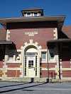
Subject: Track side view of the PRR Depot in Ridgway, PA. There is a sign across the street that says this is a restaurant named,"The Pennsy Restaurant." The sign looks nearly new but I don't see any work being done to the actual structure. Nothing obvious anyways. If it does get the conversion, I'll be back.
image/jpeg, 1536x2048 (24bit)
PRR_Track_side_view.jpg    353213 bytes

66/186


From: "Dan Syrcher" sst703 -AT- verizon -DOT- net
Date: Tue Nov 9 16:30:18 2010
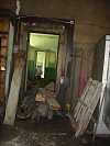
Subject: Looking down the hallway of the PRR depot in Ridgway. I did not actually get into the depot. A panel on the door was missing and allowed me to stick my arm into the depot. So, I did just that with my camera and snapped these pictures. Sad to see. This is what the East Aurora, NY PRR depot looked like when we entered it to convert it to a restaurant.
image/jpeg, 1536x2048 (24bit)
PRR_Depot_inside2.jpg    339367 bytes

67/186


From: "Dan Syrcher" sst703 -AT- verizon -DOT- net
Date: Tue Nov 9 16:18:03 2010
Subject: Close up view of the BR&P in Ridgway, PA. This depot is in very good condition as it is occupied by a senior citizen type of business.
image/jpeg, 1536x2048 (24bit)
BR+P_up_close.jpg    337323 bytes

68/186


From: "Dan Syrcher" sst703 -AT- verizon -DOT- net
Date: Fri Apr 9 23:14:02 2010
Subject: This stretch is just after horse shoe curve. See picture 3135 above.
image/jpeg, 1280x960 (24bit)
DSC03150.jpg    332377 bytes

69/186


From: "Dan Syrcher" sst703 -AT- verizon -DOT- net
Date: Fri Apr 9 22:31:11 2010
Subject: Horse shoe curve is straight ahead but still out of view. I still have about 200 feet to ascend before reaching my car.
image/jpeg, 1280x960 (24bit)
DSC03175.jpg    330212 bytes

70/186


From: "Dan Syrcher" sst703 -AT- verizon -DOT- net
Date: Tue Nov 9 16:13:37 2010
Subject: Front view of the BR&P depot in Ridgway, PA
image/jpeg, 2048x1536 (24bit)
BR+P_Front.jpg    326794 bytes

71/186


From: "Dan Syrcher" sst703 -AT- verizon -DOT- net
Date: Fri Apr 9 22:24:47 2010
Subject: Taking a moment at the last curve before coming to the end of the trail and taking in the sunset. The day was ending beautifully.
image/jpeg, 1280x960 (24bit)
DSC03186.jpg    315752 bytes

72/186


From: "Dan Syrcher" sst703 -AT- verizon -DOT- net
Date: Fri Apr 9 22:27:50 2010
Subject: Back at horse shoe curve with no sun. It's getting cold without it.
image/jpeg, 1280x960 (24bit)
DSC03181.jpg    314777 bytes

73/186


From: "Dan Syrcher" sst703 -AT- verizon -DOT- net
Date: Thu Aug 9 10:49:37 2007
Subject: This photo was taken January 2005 of the BR&P crossing at Springville,NY. This was a difficult bridge to photograph because it is blocked by trees everywhere as you can see. This is the best side view I could get with the sun lighting it up. I'm standing on the golf course.
image/jpeg, 1280x960 (24bit)
BR+P1.jpg    311576 bytes

74/186


From: "Dan Syrcher" sst703 -AT- verizon -DOT- net
Date: Fri Apr 9 22:59:05 2010
Subject: This is an aerial view of switch back 4. Just a bit to the left and out of site is the horse shoe curve.
image/jpeg, 1280x960 (24bit)
DSC03057.jpg    307700 bytes

75/186


From: "Dan Syrcher" sst703 -AT- verizon -DOT- net
Date: Tue Apr 12 21:38:07 2011
Subject: This picture was taken from East Forks Rd looking up at the mountain of switchbacks 2&3 that I just skied. SB 3 is half way up and to the right. I felt pretty good accomplishing this little trek and look forward to more of them.
image/jpeg, 2592x1944 (24bit)
IMG_0091.jpg    304417 bytes


[Previous (26 to 50)]      [Next (76 to 100)]     [All]


Railfan.net Contributor Photos Index

Railfan.net Main Page


Railfan Forums Railfan Photos ABPR Archives Staff Safari Photos Staff Safari Video Railfan Links